


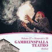
Le manifestazioni
Qui potrai trovare tutti gli eventi e manifestazioni organizzate nella nostra splendida vallata
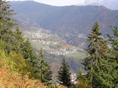
Vacanze Nella Natura
Scopri il cuore verde del Trentino. Potrai trascorre le ferie in luoghi completamente immersi nel verde a contatto con gli animali.
Le attività
Tutte le attività per giovani e meno giovani che vi permetteranno di trascorrere nel migliore dei modi la vostra permanenza nel Vanoi.

-
13/JUNE 2026

RONK’N’ROLL BBQ LAB 2026
Corso di barbecue.
-
14/JUNE 2026
Sagra del Sacro Cuore di Gesù di Zortea
Sagra patronale di Zortea
-
20/JUNE 2026

Anteprima del Vanoi Buskers Fest
20 giugno 2026 · VALLE DEL VANOI
-
21/JUNE 2026

Festa del Sorc
Giornata a Ronco Cainari con PRANZO TIPICO
-
28/JUNE 2026
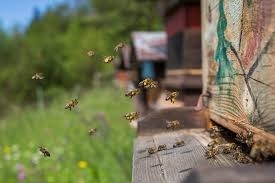
Trekking tra api e rododendri
escursione aperta a tutti
-
03/JULY 2026
Vanoi Buskers Fest
Contenitore di idee, di creatività e tecnica
-

PUNTO RACCOLTA RIUSO PER BAMBINI
CANAL SAN BOVO
-

WILD RANCH CENTRO DI EQUITURISMO
loc. GIARONI CANAL SAN BOVO
-
-
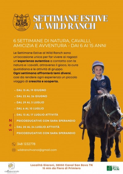
WILD RANCH WEEK
Wild Ranch loc. Giaroni
-
TORNEO PALLAVOLO
CANAL SAN BOVO PALESTRA COMUNALE
Trentino green heart


The Vanoi valley extends over a vast area of about 125 square kilometres and is mainly covered by magnificent forests.
The porphyry Lagorai chain and the massive granite peak of the Cima d’Asta characterize the natural beauty of the Valley. This extensive area, part of a natural park, remains uncontaminated and untouched by man.
Taking a holiday in the Vanoi valley means immersing oneself in nature, discovering and where simple pleasures can be enjoyed together with healthy living and a sense of well being.
Vanoi in Pills
-

What to do ...
All activities and events that Vanoi offers ...

Hospitality
Where to stay and eat during your vacation!

Winter
Snow and winter activities

Summer
Discover the Vanoi valley in the most beautiful season!

Services
All you might need.

Information Office
Visit us for any information

History and Culture
The history, legends and traditions of our valley

Suggested Itineraries
Some of the many routes you can take ...

The Proloco
Pro Loco: the backbone of the events in the Vanoi

Associations
All the associations and groups in the valley.